Backpacking on the Continental Divide and Colorado Trails
All photos are copyright by Evan Ravitz and for sale. Nonprofit use of these small images is free if credit is given. Email: evan (at) vote.org

I hiked from Boulder to Salida, Colorado the summer of 2001, about 300 miles in 40 days. This is at Devil's Thumb Pass,where I first got on the Continental Divide Trail, after hiking up local trails from my home in Boulder, 30 miles and 6,500' below.

Fraser valley on the other (West) side of the Divide.

This must be Betty Lake on the East side of the Divide.

The Iceberg Lakes. I camped at the unfrozen lake, rear left, my first night on the Divide trail.

This is from the Bard Creek Trail, the first detour from the Divide I took -to avoid the very high and still-snowy section from Berthoud Pass South to I-70, seen here 2000' below. The highest point on the Continental Divide (except for Mexico's 17,900' Volcan Popocatepetl) is Grays Peak at 14,270', the left of the 2 big ones at rear (Torreys is on the right.)

From the summit of Grays looking down on Ruby Mountain. I hoped to camp here but there was some lightning storms, so I descended 800' to the col between Grays and Edwards.

Here I camped at 13,400', my highest campsite ever. Lightning did hit Edwards and maybe Grays, so I was glad to be "down" here. The trip would have been much harder without new ultra-lightweight gear from Golite. I also recommend the vapor barrier shirt from Warmlite, who also make superior winter gear -get the lowdown on vapor barriers from Jack Stephenson, who designed the first NASA spacesuits.

Sunrise over Kelso Mountain from the col.

The goats showed up in the morning.

I used a Integal Designs 14-oz Silshelter set up over 1 ski pole with another 6 oz. of stakes. It weathered two 50-mph rain and hail storms, and sets up in 1 minute.

Goat with the gorgeous Horseshoe Basin below.

Goats admiring Kelso Mountain.
(I passed two hours of lightning and 3" of hail sitting on my pack praying just before the Divide Trail gets off the divide proper and at Georgia Pass joins the lower Colorado Trail until just after Twin Lakes.)

Miner's Creek, between Breckinridge and Copper Countain.

Camping below Kokomo Pass.


The ugliest thing on the Colorado Trail: the remnants of Camp Hale, where Colorado's 10th Mountain Division trained for WWII.


The Porcupine ponds, in the Holy Cross Wilderness NW of Leadville, have got to be the most beautiful that I saw.


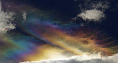
Rainbow Lake, a short detour off the Colorado Trail West of Leadville. Noon clouds seem to get rainbow colors from the shallow lake.

Coming down through the aspens to Twin Lakes.

This is Lake Creek below the Twin Lakes dam. I decided to stay on the Colorado Trail to avoid more en-lightning experiences up on the divide.

So many aspens around Twin Lakes, just over the divide from Aspen town.

I took a detour to climb Mt. Harvard, in the clouds, but bailed on account of lightning.

The remnant of Dry lake, near Salida, the end of my trip.

